【Korea】
Happy Motoring
Look

Rand McNally published its first road atlas on April 15, 1924. It was called—in a touching testament to the marketing of yore—the Rand McNally Auto Chum. Many hours of intrepid googling have failed to yield a photo of the Chum, but I did find a retrospective of atlas covers, and this commemorative press release, which catalogs some of the decidedly unchummy features of the 1924 atlas. A few of the things it didn’t do:
- Did not identify roads by number; instead roads were listed by their names, such as Roosevelt Highway. In fact, the atlas depicted zero miles of interstate, as those roads did not yet exist.
- Did not include an index for cities, or other places. If a driver didn’t know where a town was located, he or she would have to page through the atlas to find it.
- Did not appear in full color. The 1924 atlas was printed in only two colors, dark blue and red. The first full-color edition was printed in 1960.
One can only imagine the faces of so many vexed motorists as they tossed their unindexed, two-tone Chums out the windows of their stranded Model Ts.
As with so many reference texts, the road atlas has fallen into desuetude, for reasons obvious to anyone with an Internet connection. In its coverage of the Rand McNally anniversary, Yahoo! News already presumes that its readership knows nothing of atlases past; their tone is that of a nostalgic grandfather. “Before there were smart phones and Google Maps,” the story begins, “people relied on road atlases and paper maps stored in their glove boxes.” Gee!
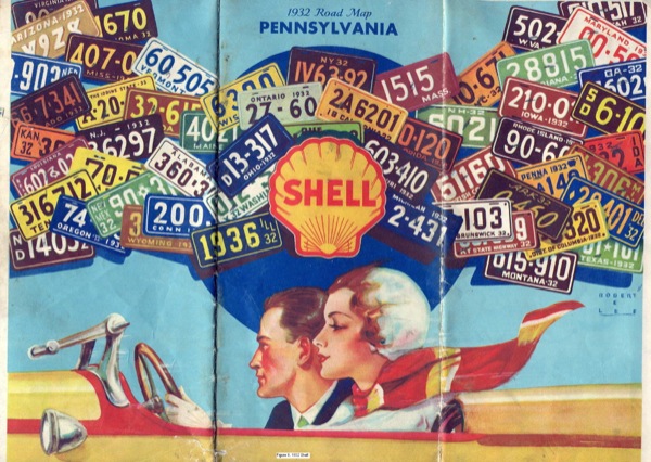
We’ve also lost the complimentary road maps once offered by gasoline companies, a few of which are pictured above. (Look closely for the title of a Flannery O’Connor short story in one of them.) It was the gas giants who helped to underwrite the cost of the first atlases: better maps meant more people on the road, and more people on the road meant more gasoline sold.
The Yale University Library hosts an old but serviceable guide to early road maps, and its text, by Douglas A. Yorke Jr. and John Margolies, provides an excellent précis on the importance of oil-company cartography, which, with its flashy art and sloganeering, amounts to a kind of petrol propaganda:
The oil-company road map became the primary medium through which Americans found their way on the ever-growing network of the national roads and highways … By the twenties, most major oil companies had some form of promotional map program. The covers often featured a man and a woman discovering the joy of driving through the countryside, enjoying the freedom and mobility the automobile offered … The 1927 Standard Oil map of Ohio compares the motorist to the pioneer in the Conestoga wagon, blazing trails and discovering new lands. The Kentucky Standard Oil map of the same year has a three panel spread, depicting a motorist using a free map to plan their descent into the rolling valley below. Oil companies were encouraging the automobile owner to travel and explore the country—using their gasoline.


Related Articles